 Fraunhofer Group for Materials and Components - Materials
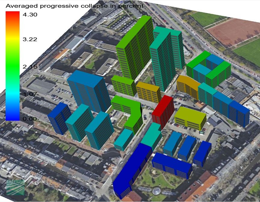
The licensed software VITRUV (Vulnerability Identification Tools for Resilience Enhancements of Urban Environments) enables the direct inclusion of safety and security aspects into city planning processes. This makes it possible to plan cities more sustainably and robustly already in the
development stages and, additionally, to identify weak spots in urban areas.
In cooperation with potential users like city planners, architects and the police, a user-friendly software was developed in the EU project VITRUV. The graphic user interface (GUI) contains a three-dimensional visualization of the city areas and uses common data formats (JPEG, DXF, CityGML).
The city under consideration can be quickly reproduced with retrievable, pre-defined building types.
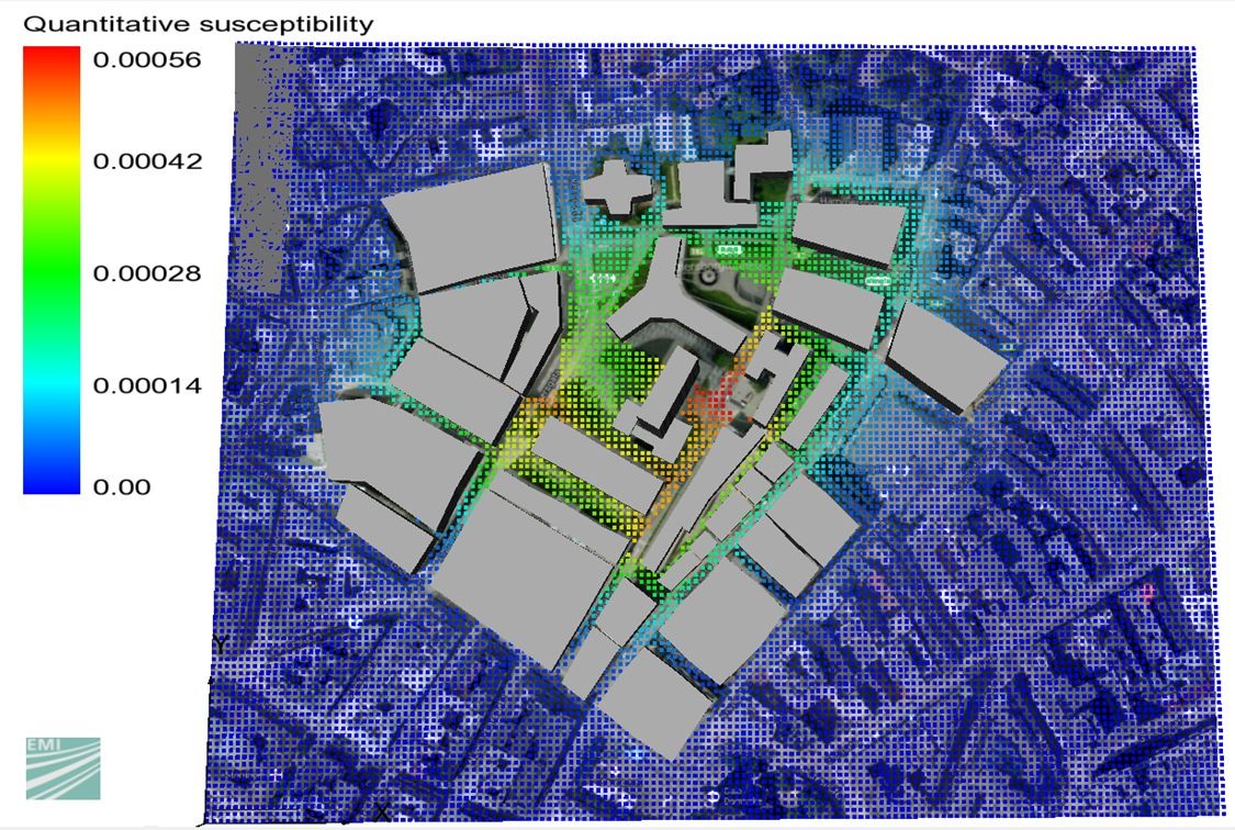
Different approaches are integrated into the vulnerability analysis of urban areas. As the first step, an empirical risk analysis enables an evaluation of the predisposition of certain areas by processing historical data. Statistical frequencies (susceptibilities) are visualized depending on the type of danger, endangered object, region and exposure. Possible damage can then be computed with the aid of a validated physical engineering model within the framework of a quantitative risk analysis.
Different performance criteria like the number of affected persons, structural or monetary damage are retrievable for buildings and traffic infrastructure elements. Different protection measures are implemented and enable an increase in the urban resilience, i.e. the robustness of cities to disturbances. These measures additionally provide decision makers with a basis for cost-benefit analyses.
Further information at www.vitruv-tool.eu